Download a convenient desk version of the 2020 Tide Chart
Quick Views:
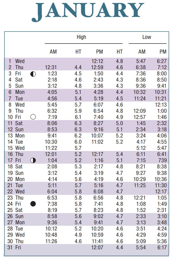
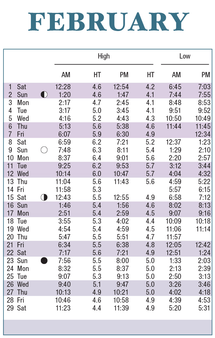
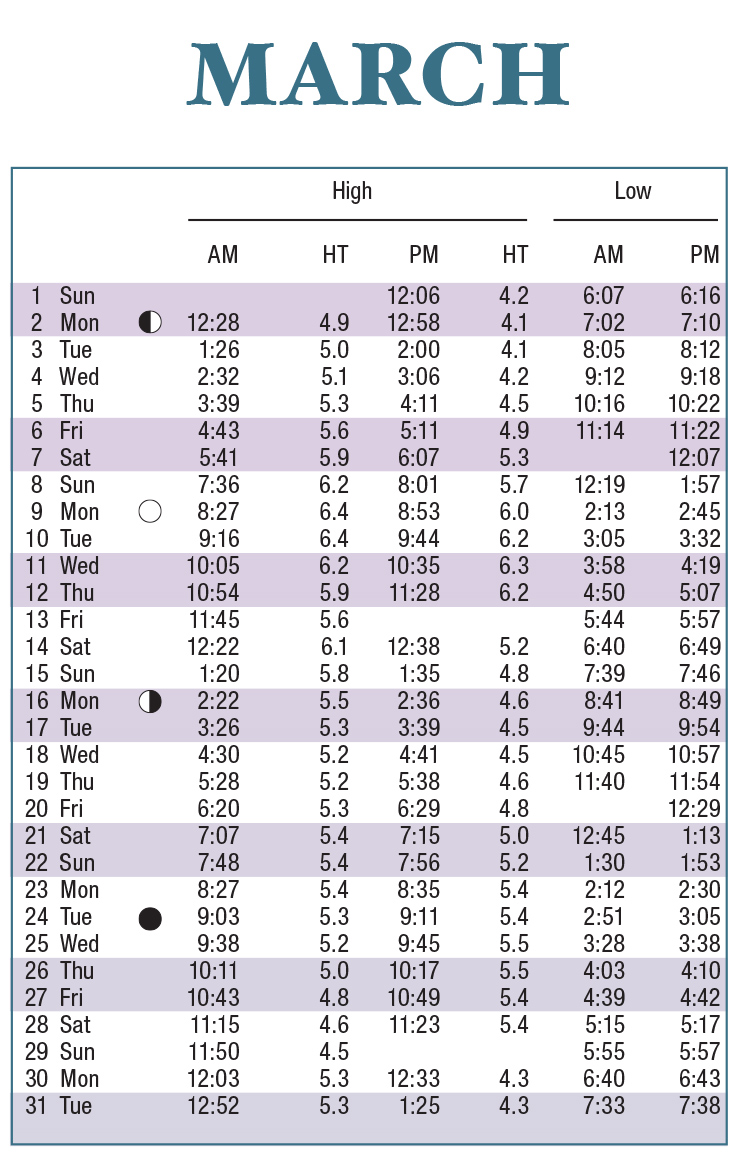
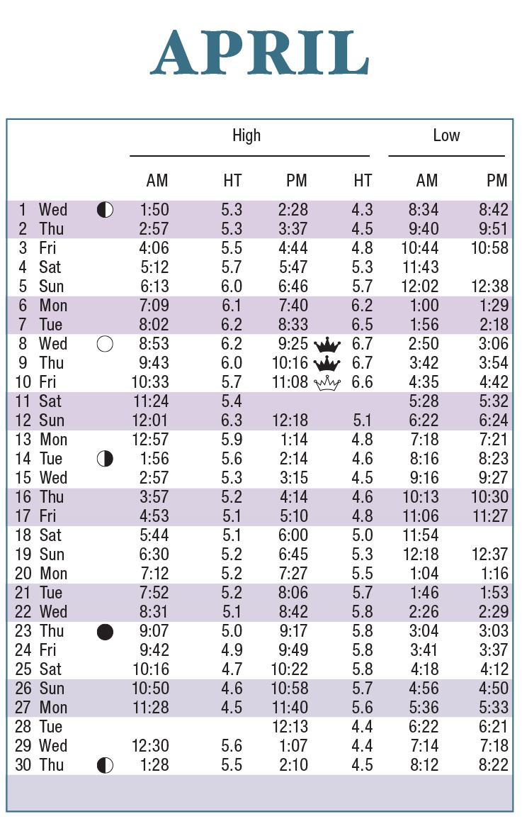
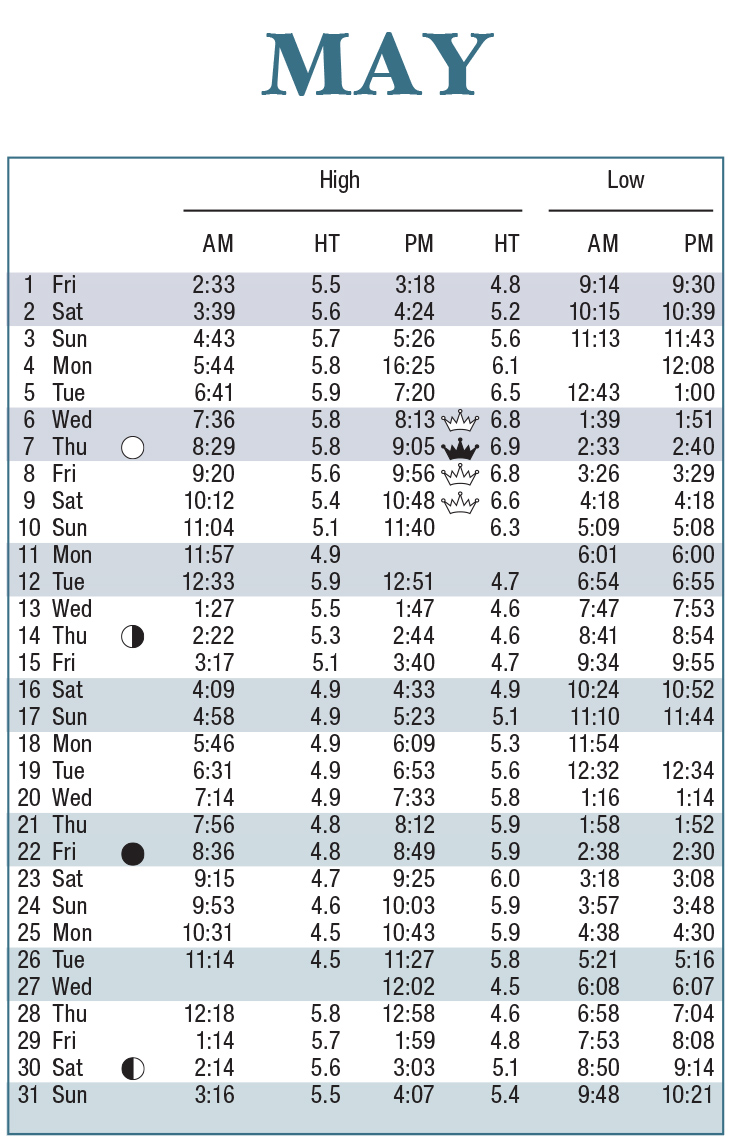
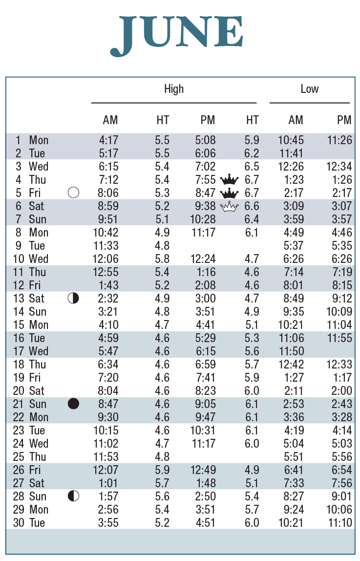
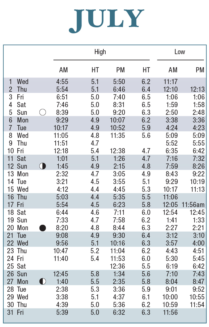
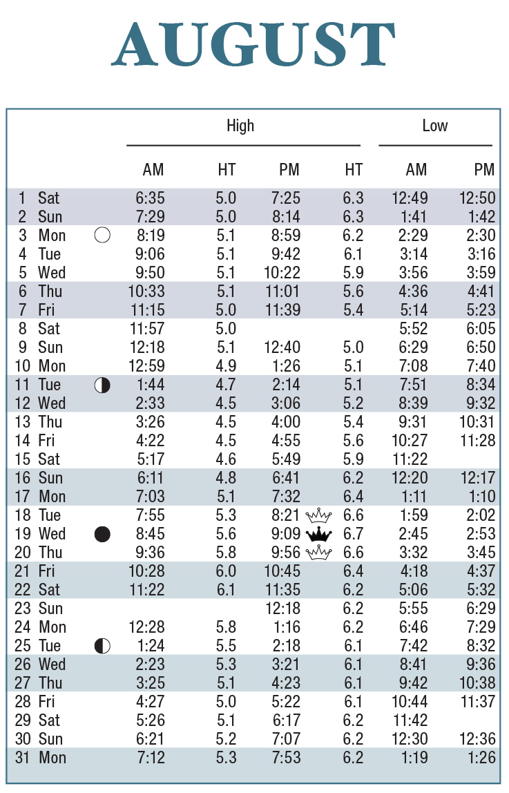
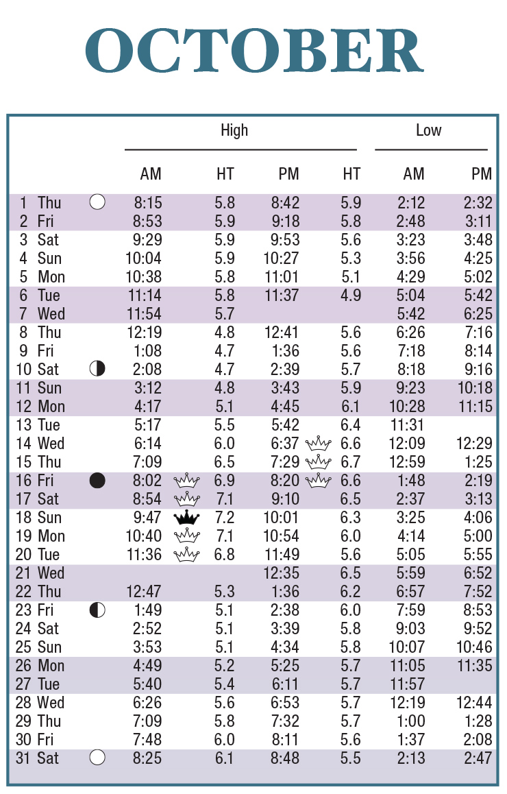
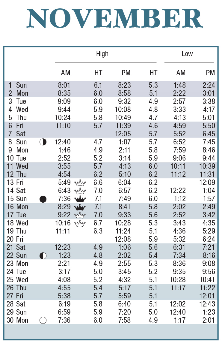
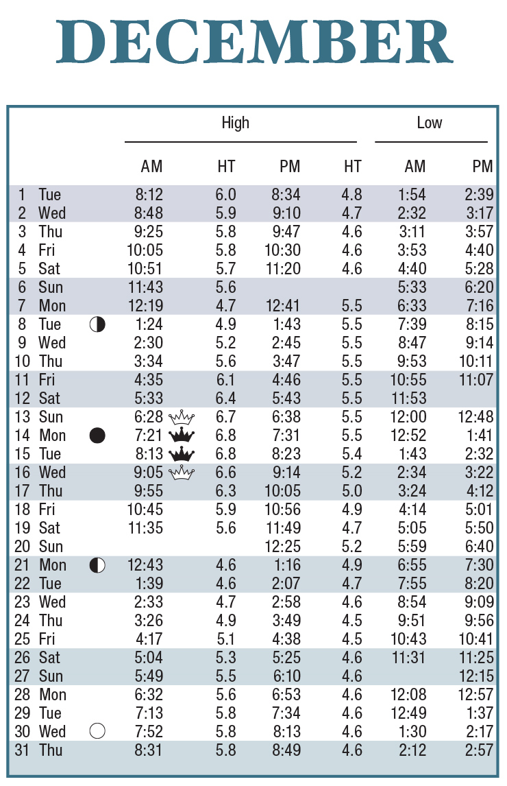
Note: All times indicated are for Charleston - Custom House. Tide heights relative to Mean Lower Low Water.
Tide data provided courtesy of the National Oceanic and Atmospheric Administration (NOAA)
Location Correction Information
| Location |
High Tide |
|---|---|
| Cherry Grove | +10 min. |
| Myrtle Beach, Springmaid Pier | -26 min. |
| Socastee Bridge ICWW | +3 hr. 26 min. |
| Garden City Pier | -26 min. |
| Litchfield Beach Bridge | +44 min. |
| Pawleys Island Pier | -24 min. |
| Winyah Bay Entrance | -21 min. |
| Georgetown, Sampit River | +1 hr. 25 min. |
| Isle of Palms Pier | -25 min. |
| Cooper River, Goose Creek Entrance | +43 min. |
| Ashley River, Magnolia Gardens | +1 hr. 02 min. |
| Stono River, Limehouse Bridge | +1 hr. 43 min. |
| Edisto Beach (Approximate) | -25 min. |
| Skull Creek, North Entrance (Approximate) | +22 min. |
| Beaufort, (Approximate) | +1 hr. 04 min. |
| Bluffton, River (Approximate) | +1 hr. |
Distribution Locations - Limited to Supply On-Hand
The 2020 Tide Tables Posters are now available! Quantities will be limited to supply on-hand at select DHEC-OCRM office locations.
Myrtle Beach/Grand Strand
927 Shine Ave.
Myrtle Beach, SC 29577
Charleston
1362 McMillan Ave.
Suite 400
Charleston, SC 29405
Beaufort
104 Parker Drive
Beaufort, SC 29906
Tide Charts are not intended for individual retail sale.
For all order inquiries, please contact Elizabeth Hartje, 843-953-9237.